
Key Highlights
- Multiple rounds of snow expected across the Great Lakes region through next Tuesday.
- Arcitc blast will send temperatures plummeting to single digits and below zero on Monday morning.
- Heaviest snowfall likely in Northern Michigan, along Lake Michigan shoreline and eastern Upper Peninsula.
- Another clipper system brings light snow accumulations and potential wintry mix from Monday night into Tuesday.
The Forecast for the Great Lakes Region: Winter’s Early Arrival
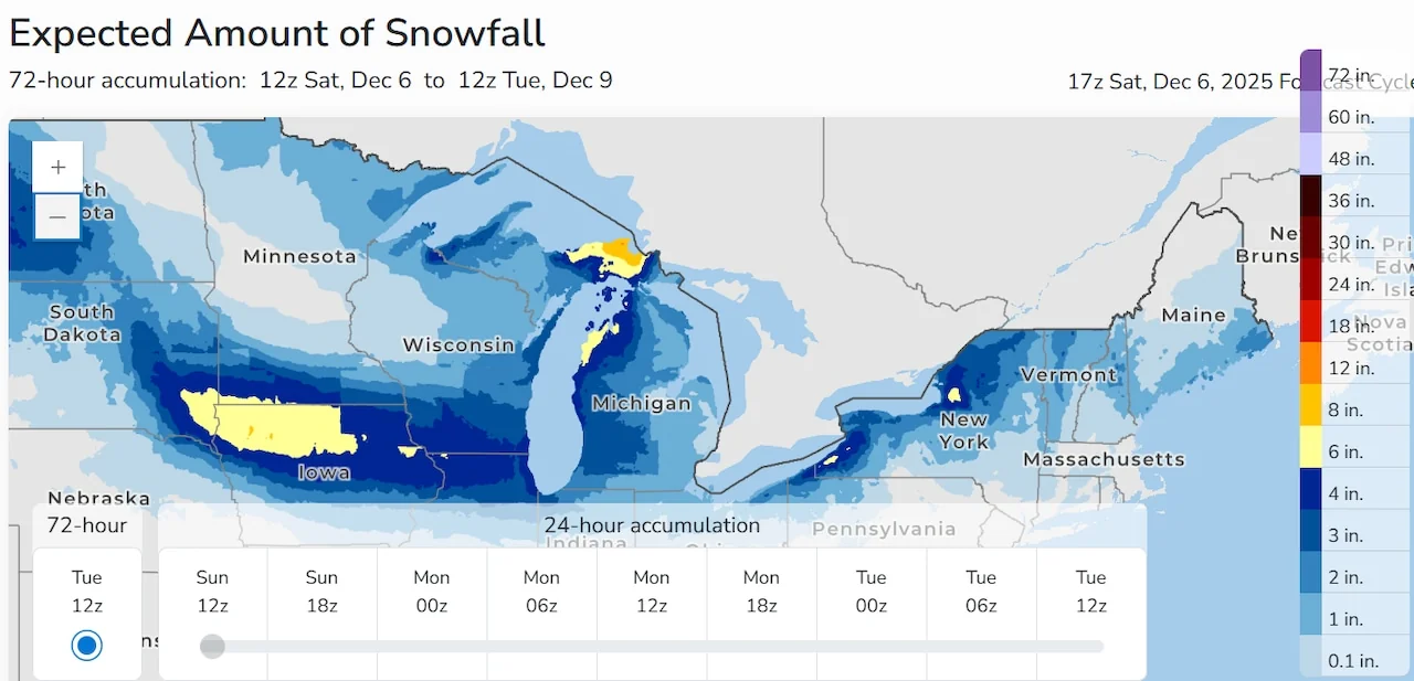
As the month of December draws closer, residents in Michigan are getting a taste of what cold winter weather can bring. According to the National Weather Service (NWS), multiple rounds of snow are expected to blanket much of the state through next Tuesday, starting with an early weekend storm.
Saturday Night into Sunday: A Preview of Winter
Starting Saturday night and continuing into Sunday, a significant snow event is forecasted. The NWS predicts that most areas will see just a scant inch or two of snowfall, but this sets the stage for what’s to come.
The Arctic Blast: Monday Morning’s Chill
As the Arctic air begins its return, Michigan residents can expect temperatures to drop into the single digits on Monday morning. Wind chills are expected to plummet below zero, creating dangerously cold conditions. The NWS advises dressing in layers and covering hands and faces to stay safe.
Clipper Systems: Multiple Snow Showers Through the Week
The weather pattern is not a one-time event but rather an active sequence with multiple chances for additional snow. A mid-week storm system could bring a mix of snow and ice, making travel conditions challenging in certain areas.
Northern Michigan along Lake Michigan’s shoreline and the eastern Upper Peninsula are expected to bear the brunt of the heaviest snowfall over the next few days. The NWS highlights that these regions can anticipate accumulations of 2 to 3 inches, with lighter amounts predicted for southern parts of the state.
Stay Prepared: Safety Tips for Winter Travel
Given the forecast, travelers should be prepared for slippery road conditions on Sunday morning. The NWS reminds residents that maintaining visibility and traction will be crucial during this period. For those who must venture out, it is recommended to use chains or winter tires where appropriate.
The active weather pattern will persist through at least mid-December, with more clipper systems bringing in additional snow showers.
While the temperatures are expected to moderate slightly by Wednesday, another surge of Arctic air is anticipated later in the week, setting the stage for a potentially long and cold stretch ahead.
As this winter season gets underway, it’s essential for Michigan residents to stay informed about weather updates and prepare accordingly. The NWS advises keeping an eye on local forecasts and taking necessary precautions to ensure safety during these cold and snowy conditions.